")
")


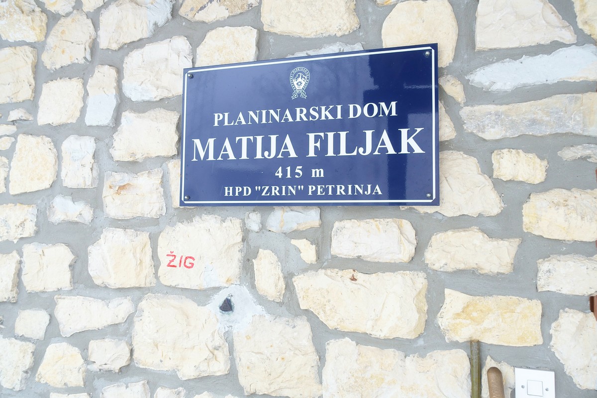
This is the highest point of the 500 m long reef with two smaller summits above 400 m. In the older maps the summit of The Hrastovica Hill is named "Cepeliš" after the village on its foot, but local people call it "Piramida" (The Pyramid). There is a geodetic pyramid about 14 m tall. Just a few tens meters from the top there is new mountain lodge Matija Filjak.
- Location: 45° 23,7632' N, 16° 16,5502 E
The summit is surrounded by young chestnuts forest that closes nice views and because of this, it is built a belvedere around geodetic pyramid. Another near nice view (to south) is from the belvedere at the Chestnuts trail, 10 min of walking from the lodge.
Mountain Lodge Matija Filjak
A few tens meters from the summit there is the mountain lodge "Matija Filjak". The information about lodge can be found at The official pages of the hiking club HPD-Zrin Petrinja or at the Lodge Facebook page
- The lodge is built at the place of the old destroyed mountain lodge from 1938 year. The construction is mostly sponsored by European Union founds from the CARDS program, via Samaritan Workers Union - Arbeiter-Samariter-Bund (ASB) from Germany.
- At the wall of the hut there is the metal stamp of the Croatian Hiking Trail.
{gallery height= 150 alignment=right}galleries/hiking/banovina/hrastovacka_gora-summit/DSC02690.JPG{/gallery}
Geodetic pyramid and the belvedere
- There was a wooden belvedere around pyramids but it is run out. New, with solid metal construction belvedere is built in summer 2019.
Chestnuts Trail
- Close to the lodge there is signed easy half hour walking rounded trail named the Chestnuts Trail. It passes through nice chestnuts forest, near former Pecki lake, the belvedere and the place for barbecue.
Plateau and parking
- There is a plateau just 250 m souther n from the summit (3 min of walking). It is convenient for parking a few cars. This is the end of forester road, the branch from the road Cepeliš - Pecki
Distances
- Hrastovica (via Vodovod) - 45 min
- The ruins of the St. Spirit Church - 30 min
- The ruins of the castle Hrastovica - 30 min
- Petrinja - 2 h
- G. Bačuga - 30 min
Hiking trails and other accesses to the summit
- The summit is accessible by car or bicycle using non-asphalted road 4 km long, separated from the road Cepeliš (village) - Pecki. After heavy rains and snow the road can be in a bad condition and non passable for normal cars.
 Hiking trails begin at:
- Petrinja, via Cepeliš village - about 2,5 hours of walking
- more information about that - Northern approach can be found here
- Hrastovica (a village 5 km far from Petrinja) - about 1 - 1,5 h of walking
- more information about that - Eastern approach can be found here
- Gornja Bačuga, village - about 40 min of walking
- Zelena Dolina motel - about 1 h 15 min of walking
- more information about that - Southern approach can be found here
- The approach to the summit from Petrinja is shared with the route of Petrinjska Šetnica (The little promenade around Petrinja).

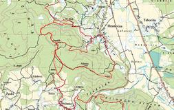
The Maps
- Topographic map TK25, sheet "Petrinja", Scale 1:25 000, Državna geodetska uprava, Zagreb, 2006.
- The excerpt of the topographic map with drawn hiking trails is here