")
")


Intro
The main approach is from Gornja Bačuga village.
Gornja Bačuga is accessible by car via an asphalt road (the right branch of the road Hrastovica - Jabukovac, after the Zelena Dolina motel and the bridge over Petrinjčica) There are two main approaches from the south
- From Zelena Dolina Motel via Gornja Bačuga
- Gornja Bačuga is accessible by car (asphalted road) and this is the shortest and easiest approach
- From Tješnjak canyon
Routes description
Motel "Zelena dolina" - Gornja Bačuga - 45 min (1 h 30 min to the Summit)
- From the motel, by the road and after the bridge over Petrinjčica, to the right, The trail passes a motto-cross polygon. The trails goes along the river, downstream and after 15 min, passes abandoned railway trails and it goes up through a small canyon to Gornja Bačuga village, to a part called Prečanice. It continues near waterworks, and a graveyard toward a chestnut forest.
- After the forest on the crossing, to the right and at the crossing at the chestnut plants, to the left. After a few minutes, again to the left and through the meadow to the belvedere on the Chestnuts trail. Further, through the forest, 10 min to the plateau (parking place) and 5 minutes to the hut.
Gornja Bačuga - the Summit of Hrastovačka Gora - 40 min
- From the end of the asphalt road and the left branch to Bižići, go straight toward Bjelovac. At the next crossing, at the beginning of the forest, go half-right and up.
- later, inside forest, there are two branches,.
- The left branch goes directly to the parking plateau below the hut.
- The right branch goes along the edge of the forest to the belvedere.
- From the plateau to the summit there is a 5 minutes’ walk.
Tješnjak - The summit
From the bridge, by a forest road and to the right, crossing abandoned railway trails, and 15 min up. Before the village of Gornja Bačuga, there is a good spring "Oblakovića Vrelo. In the village there is the connection with the trail from Zelena Dolina Motel.Trail passes along graveyard, then on the crossing, on the right, upward.
After 200 hundreds meters, turning on the left and 100 m after on the left again via meadows toward belvedere on Chestnuts trail ("Put kestena").
From the belvedere there are still 15 minutes to the hut,
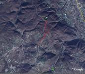
Maps:
-
In order to view these trails on GoogleMaps, please click on the icon of the GoogleMap:
- The area is covered by topographic maps TK25 (scale 1:25.000) issued by Državna Geodetska Uprava, sheets "Petrinja" (45216-2-2-1) and Kraljevčani (45216-2-2-3).
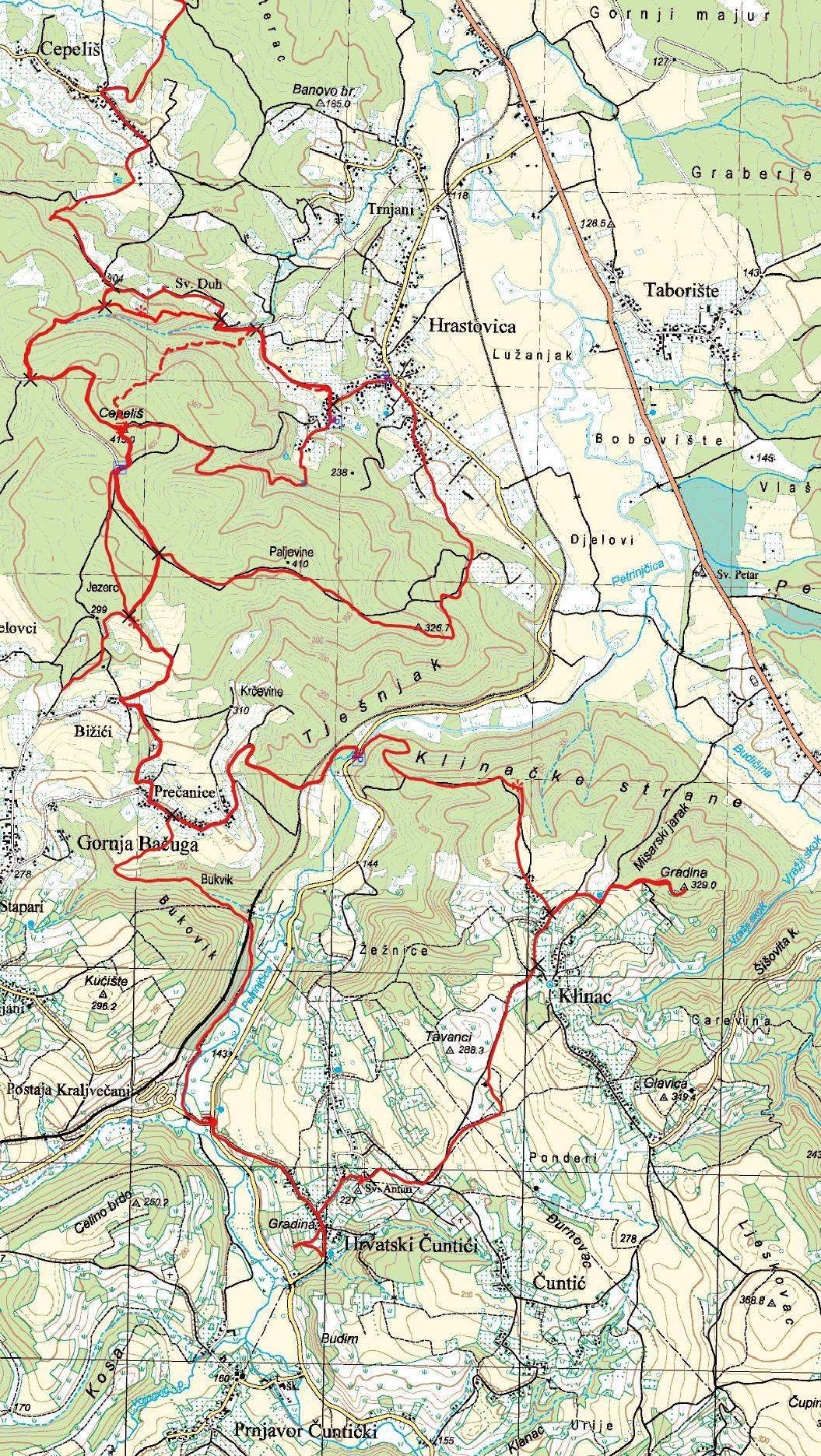
Approaches from the south at topographic map 1:25.000