")
")


Hrastovačka gora (Hrastovica Hill), 415 m - General information
Introduction
- This is a local mountain for the citizens of towns Petrinja and Sisak. It was relatively unknown to hikers but now it is part of The Croatian Hiking Trail (Hrvatska planinarska obilaznica) The mountain hut is ready for opening and there are many signed trails.
- Hrastovačka Gora (also called HrastovIčka gora, too) is a low forested mountain (max altitude is 415 m), placed a few kilometers SW from Petrinja (about 60 km S from Zagreb).
- It is named after the village of Hrastovica, placed at its foot. The origin of its name is a little controversial because there are two names in Croatian: Hrastovačka Gora and Hrastovička Gora. The first one is used by local people and the other is more frequently used in older references.
- Additional information about The Hrastovica Hill can be found in excerpt from the hiking guide "Upoznajmo Hrastovičku goru" written by Đuro Priljeva and Marko Kovačević. The guide is used for the basis of trails description through The Hrastovica Hill. It contains a brief overview of the history of Petrinja.
Hrastovička Gora - The Summit (415 m)
In the maps The summit of The Hrastovica Hill is named "Cepeliš" after the village on its foot, but local people call it "Piramida" (The Pyramid). There is a geodetic pyramid about 14 m tall.
{gallery height= 150 alignment=right}galleries/hiking/banovina/hrastovacka_gora-summit/DSC02690.JPG{/gallery}
A few tens meters from the summit there is the mountain lodge "Matija Filjak". The information about lodge can be found at the official pages of the hiking club HPD-Zrin Petrinja.
More information about the summit, the mountain lodge can be found here
Hiking trails and other accesses to the summit
- The summit is accessible by car or bicycle using unasphalted road 4 km long, separated from the road Cepeliš (village) - Pecki. After heavy rains and snow the road can be in a bad condition and non passable for normal cars.
- Hiking trails begin at:
- Petrinja, via Cepeliš village - about 2,5 hours of walking
- more information about that - Northern approach can be found here
- Hrastovica (a village 5 km far from Petrinja) - about 1,-1,5 h of walking
- more information about that - Eastern approach can be found here
- Gornja Bačuga, village - about 40 min of walking
- Zelena Dolina motel - about 1 h 15 min of walking
- more information about that - Southern approach can be found here
- The approach to the summit from Petrinja is shared with the route of Petrinjska Šetnica (The little Promenade around Petrinja).
Klinačke Strane
Klinačke Strane (or Klinačka Strana) are Zrinska Gore slopes. They are separated from Hrastovička Gora by Petrinjčica river valley. there are two castles, St Francisco monastery of St. Anthony. The trip to this area can be combined with the trip to Hrastovička Gora - southern approach in one trip of 5-6 h of walking with a lot of things worth of seeing.
Guide to Klinačke Strane is given in the article Klinačke Strane, Klinac Castle, St. Anthony Monastery and Čuntić Castle.
Petrinjska šetnica (The little promenade around Petrinja)
{gallery height= 150 alignment=left}galleries/hiking/banovina/petrinjska_setnica/DSC03751.JPG{/gallery}
This is a circle trail, about 6 km long. Its route leads along the river Petrinjčica, through the hills around Petrinja, and close to the former Petrinja restaurants Vila and Pigik.
It takes less than two hours of walking
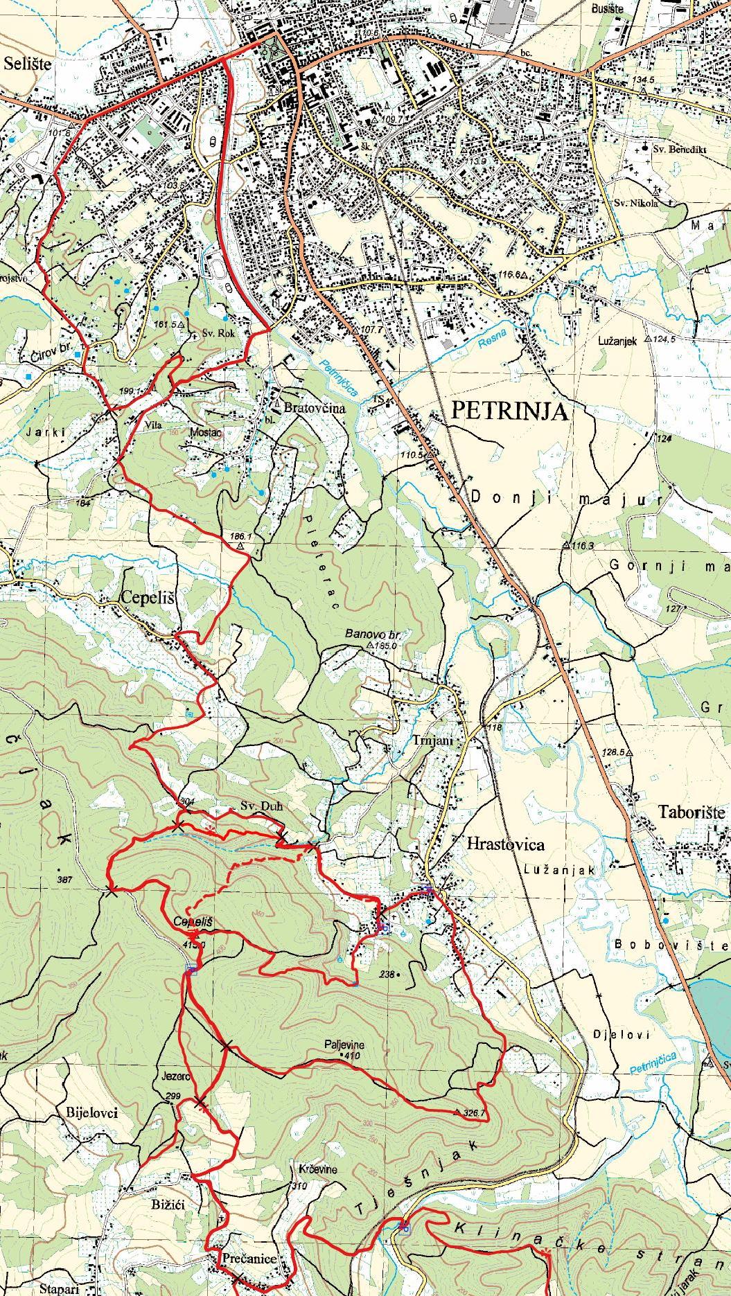
The Maps
- The map of Hrastovica Hill with drawn hiking trails
- Petrinja, Topographic map, Scale 1:25 000, Državna geodetska uprava, Zagreb, 2006.