")
")


In the process of creating maps I am using data recorded by GPS receiver, old Croatian topographic maps (1:25000, Gauss-Krueger coordinate system, Transverse Mercator projection), outlines from trips and maps owned by my hiking society (HPD Zrin).
The published GPS data are given in the best manner without any guaranties and responsibility taken. The users are responsible for verifying these data. They are free to use for non commercial purposes.
Some GPS tracks are recorded during bicycle ride.
Used applications:
Map Datum:
- CROATIA (GPS: Garmin Foretrex 201)
- Ellipsoid name: Bessel 1841
- Semi-major axis: 6377397,155
- Flattening: 299,1528128
- Geodetic datum->WGS
- dX: 675 dY: -205 dZ: 475 -TrackMaker, OziExplorer
Coordinate system:
- Gauss-Krueger, Transverse mercator
- False easting:
- 5500000 (Zone 5, < 16,5°)
- 6500000 (Zone 6, > 16,5°)
- False northing: 0
- Scale factor: 0,9999
References:
Tomislav Hengl: Coordinate systems in Croatia (HR)
Importing Maps into OziExplorer (HR)
Importing Maps into OziExplorer (HR)
Notes:
- Please, any objections send me by E-mail (at Contact me page). All ambiguous and missing data can be important for others.
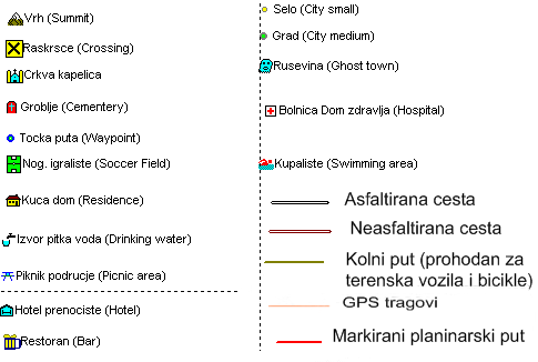
Legend of symbols used in my maps