• Veliki kozjak and Lubenovac

    from Hajdučki Kukovi
  • Krupa Canyon

    below Ravni Golubić
prev next
×

Error

[SIGPLUS_EXCEPTION_SOURCE] Image source is expected to be a full URL or a path relative to the image base folder specified in the back-end but travels/dalmatia/mljet-po_vrsima_2012-04-29/slides/DSC04684.JPG is neither a URL nor a relative path to an existing file or folder.
[SIGPLUS_EXCEPTION_SOURCE] Image source is expected to be a full URL or a path relative to the image base folder specified in the back-end but travels/dalmatia/mljet-veliki_grad_2012-04-28 is neither a URL nor a relative path to an existing file or folder.
[SIGPLUS_EXCEPTION_SOURCE] Image source is expected to be a full URL or a path relative to the image base folder specified in the back-end but travels/dalmatia/mljet-po_vrsima_2012-04-29/slides is neither a URL nor a relative path to an existing file or folder.
[SIGPLUS_EXCEPTION_SOURCE] Image source is expected to be a full URL or a path relative to the image base folder specified in the back-end but travels/dalmatia/mljet_2012-04-30/slides is neither a URL nor a relative path to an existing file or folder.
[SIGPLUS_EXCEPTION_SOURCE] Image source is expected to be a full URL or a path relative to the image base folder specified in the back-end but travels/dalmatia/mljet-cro_hikers_days_2012/slides is neither a URL nor a relative path to an existing file or folder.

{gallery count=1 alignment=right width=240 height=240}travels/dalmatia/mljet-po_vrsima_2012-04-29/slides/DSC04684.JPG{/gallery}
When: 27th April to 1st. May 2012.

Where: Mljet, Babino Polje, camp Mungos

Routes:

  • Sobra - Veliki Grad - Babino Polje
  • Blato - Put po Vrsima - Montokuc - Pomena
  • Babino Polje - Odisejeva špilja

Altude difference (max): 514 m (vidjeti visinske profile pojedinih ruta)

Difficulty: easy to medium (due to distances)

Ukratko: Prvi puta na Danima Hrvatskih planinara, prvo planinarenje po Mljetu te najranije ugodno kupanje u moru (28.4). Sve u svemu, nezaboravno.

{gallery}travels/dalmatia/mljet-veliki_grad_2012-04-28{/gallery}

Routes:

  • 28th April

{gallery}travels/dalmatia/mljet-po_vrsima_2012-04-29/slides{/gallery}

  • 29th April
  • 30.4 

{gallery}travels/dalmatia/mljet_2012-04-30/slides{/gallery}

Notes from the trips:

Photo-albums:

{gallery}travels/dalmatia/mljet-cro_hikers_days_2012/slides{/gallery}

Equipment:

  • Kamp oprema i uobičajena planinarska oprema za višesatne rute.

Maps and GPS data:

  • Otok Mljet, Turističko-planinarski zemljovid, 1: 20.000, HGSS
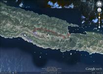
  • Za prikaz GPS tragova izleta u GoogleMaps kliknite na sličicu karte:

Accomodation:

  • Kamp Mungos, Babino Polje
  • privatni apartmani u Sobri

Approach:

  • ferry from Prapratno, peninsula Pelješac

Recent trips

Zugspitze and Partnachklamm, 2021-07-17


Destinations:

  • Partnachklamm
  • Zugspitze

Tagline:  The ascent to the highest peak of Germany, Zugspitze (2962 m) via attractive and difficult route with warming-up trip to the Partnachklamm canyon, close to Garmish-Partenkirchen. 

Read more ...

7 waterfalls of Mirna, 2021-04-03


Destination: 7 waterfalls - hiking trail, Istria

Starting and ending point: Buzet (parking at Water supply / Brewery)

Length: about 5 h (13,5 km)

Elevation gain: around 350 m (elevation profile is here)

Difficulty: Easy signed way (with some steep parts)

Tagline: Nice trip through amazing landscapes of rivers Mirna and Pivka.

Read more ...

Hrastovička Gora, Damages by Earthquake and Mt Lodge Provisional Fixing


In the catastrophic earthquake that hit Petrinja, Glina, Sisak and the surrounding area on December 29, 2020, the Matija Filjak Mountain Lodge was also damaged, and the geodetic pyramid at the top was destroyed.

Read more ...