{gallery count=1 alignment=right width=240 height=240}travels/dalmatia/mljet-po_vrsima_2012-04-29/slides/DSC04684.JPG{/gallery}
When: 27th April to 1st. May 2012.
Where: Mljet, Babino Polje, camp Mungos
Routes:
- Sobra - Veliki Grad - Babino Polje
- Blato - Put po Vrsima - Montokuc - Pomena
- Babino Polje - Odisejeva špilja
Altude difference (max): 514 m (vidjeti visinske profile pojedinih ruta)
Difficulty: easy to medium (due to distances)
Ukratko: Prvi puta na Danima Hrvatskih planinara, prvo planinarenje po Mljetu te najranije ugodno kupanje u moru (28.4). Sve u svemu, nezaboravno.
{gallery}travels/dalmatia/mljet-veliki_grad_2012-04-28{/gallery}
Routes:
- 28th April
- Sobra - Veliki Grad (514 m) - Babino Polje - 5 h
{gallery}travels/dalmatia/mljet-po_vrsima_2012-04-29/slides{/gallery}
- 29th April
- Blato - Put po Vrsima - Montokuc - Pomena (5 h)
- 30.4
- Babino Polje (kamp Mungos) - Odisejeva špilja (40 min)
{gallery}travels/dalmatia/mljet_2012-04-30/slides{/gallery}
Notes from the trips:
Photo-albums:
- Sobra - Veliki Grad (514 m) - Babino Polje
- Trail "Po Vrsima", from Blato do Pomena
- Odisseus cave
- The camp and Mljet Lakes
{gallery}travels/dalmatia/mljet-cro_hikers_days_2012/slides{/gallery}
Equipment:
- Kamp oprema i uobičajena planinarska oprema za višesatne rute.
Maps and GPS data:
- Otok Mljet, Turističko-planinarski zemljovid, 1: 20.000, HGSS
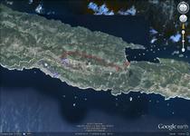
- Za prikaz GPS tragova izleta u GoogleMaps kliknite na sličicu karte:
Accomodation:
- Kamp Mungos, Babino Polje
- privatni apartmani u Sobri
Approach:
- ferry from Prapratno, peninsula Pelješac


