")
")


{gallery count=1 alignment=right width=240}travels/dalmatia/hum_2017-06-16/medium/DSC00542-011.jpg{/gallery}
Destinations:
- Marjan (178 m)
- Hum (587 m), Island Vis
- Biševo
- Promenade above Komiža
Difficulty:
- Easy signed ways (except the Promenade above Komiža - unsigned)
Tagline: Traditional June trip PD Ericsson Nikola Tesla hiking club to the Vis island. There were four small trips in four days, at pleasant housekeeper Krešo.
Routes:

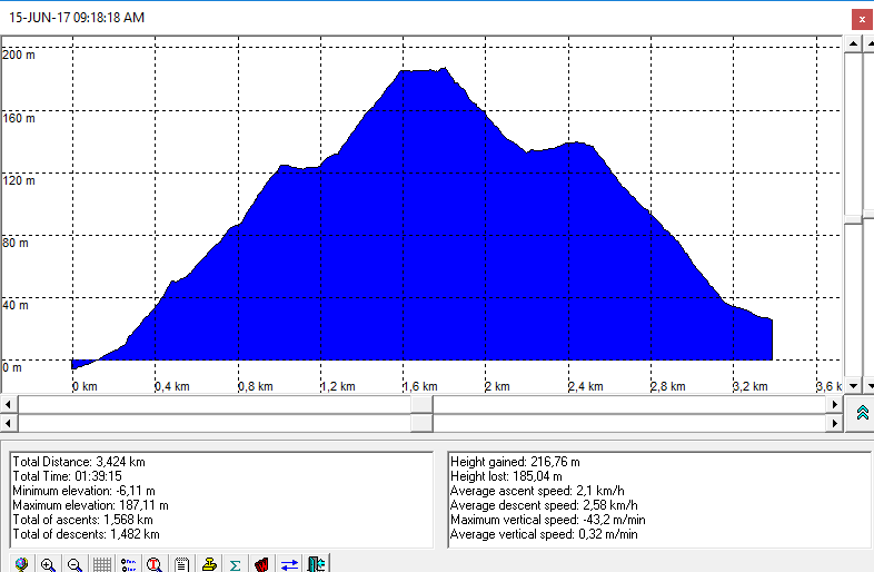
- Split (riva) - Marjan - Split (riva): 1,5 h
The altitude profile of the trail is here
A nice samll trip during waiting for ferry to Vis.
Photo-album by Dražen is here
In order to show the GPS tracks from the trip to Marjan in GoogleMaps app click on the map icon:
{gallery count=1 height=150 alignment=right}travels/dalmatia/marjan_komiza_2017-06-15/medium/DSC00442-017.jpg{/gallery}
Approach
From the St. Frane church, by street Šperun, then Senjska street and further through park.
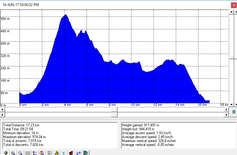
- Komiža - Hum (587 m) - Tito's cave - Žena Glava - Mt. Hut St. Andrews (Sveti Andrija) - Vis: 5 h eff, 17, 5 km.
The altitude profile of the trail is here
Photo-album by Dražen is here
In order to show the GPS tracks from the trip to Hum in GoogleMaps app click on the map icon::
{gallery count=1 height=150 alignment=right}travels/dalmatia/bisevo_2017-06-17/medium/DSC00727-015.jpg{/gallery}
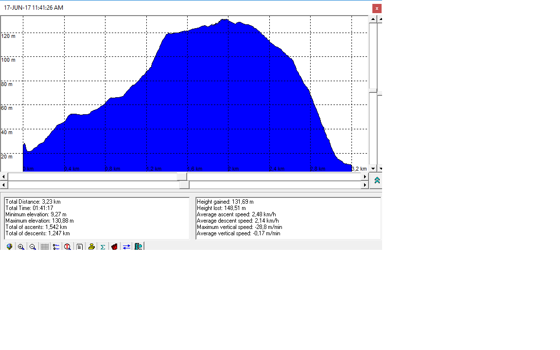
- Mezoporat (Plava špilja ) - Biševo - Porat - 1 h eff.
The altitude profile of the trail is here
Photo-album by Dražen is here
In order to show the GPS tracks from the trip to Biševo in GoogleMaps app click on the map icon::
Pristup
By ship line Komiža - Biševo to Mezoporat. Further, by boats of Nautičcal Centre Komiža to Blue Cave (Modra špilja). Hiking to Porat. The return is by regular ship-line from Poarat
- The Promenade above Komiža (unsigned trail)
Photo-album by Dražen is here
Maps
Vis Island, touristic and trekking map, 1:20.000, HGSS
Group members:
- Božo, Željka, Neda and Zdravko and Dražen from PD ENT and joined, including future hikers
{gallery count=1 height=150 alignment=right}travels/dalmatia/nad_komizom_2017-06-18//medium/DSC00868-015.jpg{/gallery}