{gallery count=1 alignment=right width=240 height=240}travels/velebit/north/zavizan-ascent_2013-02-28/slides/DSC00496.JPG{/gallery}
Destination: Mt. lodge Zavižan (1594 m)
Difficulty: difficult, due to winter conditions.
Altitude difference: 650 m
Starting and ending point: Mt Hut Oltari (on the road Sv. Juraj - Krasno - Otočac)
Tagline:
- Three musketeers (Zoran, Saša and Dražen) on three meters of snow at Zavižan. It was one of the easiest winter ascents to Zavižan thanks to very hard snow, passable without snowshoes and crampons. Amazing weather and a lot of snow give us a lot of motives for photographing. One curiosity.. one of the hiking trips when we saw the dolphins (of course, in the sea close to Sv. Juraj),
Route:
- Oltari (950 m) - Siča (1250 m) - Mt. Lodge Zavižan (1594 m) : 3, 5 (4,5) h
- Mt. Lodge Zavižan - Velika Kosa - Mt. Lodge Zavižan : 1 h
- Mt. Lodge Zavižan - Siča - Babić Dolac - Oltari
{gallery}travels/velebit/north/zavizan-ascent_2013-02-28/slides{/gallery}
Notes from the trip:
- Photo-album from the ascent by Dražen
- Photo-album from Kosa, Vučjak and from the descent by Dražen
Transport: individually, by car
Acommodation:
Maps:
- Nacionalni park Sjeverni Velebit, Map No 16a, M 1:30.000, SMAND d.o.o., Varaždin, 2005.
- Sjeverni Velebit, Map No 16, M 1:30 000, SMAND d.o.o., Varaždin 1995.
- Topographic map TK25 Rab-2-4 (418-2-4), M 1:25000, Državna geodetska uprava, Zagreb
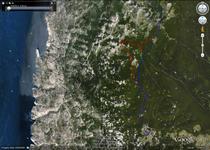
- The view of theGPS tracks from the trip in GoogleMaps
Guided by: Dražen
Organizers: Saša and Dražen
Equipment:
- Mandatory
-
appropriate winter clothes for wind, snow and rain.
-
hiking boots for winter condition
-
gaiter
-
hiking poles
- UIAA member identity card
-
-
highly recommended, it can be mandatory depending on weather condition:
-
snowshoes
-
crampons
-
iceaxe
-
-
optionally:
-
backcountry skis
-
Notes from previous trips:
- Winter ascent to Zavižan, Dec 15-16, 2012
- North Velebit - Winter ascent to Zavižan, Jan 6-8, 2012
- North Velebit - Winter Ascent to Zavižan, 10-12th December 2010
- North Velebit - Winter Ascent to Zavižan, 11-13th December 2009
- North Velebit - Winter Ascent to Zavižan (1594 m), 29-30th November 2008
- North Velebit - winter Ascent to Zavižan, 1-2nd December 2007
Notes:
- Zavižan is usually the coldest, the windiest and the snowiest place in Croatia! This demands the experience, appropriate equipment and good personal physical preparation. Etc, at the trip 27/28th Feb 2010. there were 156 cm of snow and temperature of +7 C, but at the trip before (11th Dec 2009) there were half meter of snow, -9 C and the wind (bora) about 60 km/h


