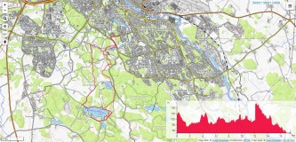
Destination: Tinnerö eklandskap
Starting and ending point: Smedstat Dammar (parking)
Length: 17,5 km Time needed: 5 h
Altitude difference: 25 m
Trail type: Easy walking
Tagline: Very nice walking through oak woodland, meadows and around the Lake Rosenkällasjön. A lot of wildness just a few km from the center of Linköping. My route was 17,5 km long, but it can be shortened or prolonged or combined with a bike. The trails through forests and the trail the closest to the lake are accessible by foot, only. The rest is accessible by bike (or by horse riding).
Route: Smedstat Dammar (parking) -> Humpen -> Löfhagen -> Rosenkällasjön -> Rödberget -> Fröberget -> Smedstat Dammar
Approach (from Linköping): Bus no 17, exit Grocery Store Garnizonen, or by foot.
Notes from the trip:
Photo-album: Photo-album by Dražen
- Linköping, Sverigeserien - Topo50, Blad 40, Norsteds kartor
- Tinnerö eklandskap, Reservatfolder (pdf)
- OpenTopoMap (© CC-BY-SA) on-line map of the area is here
Gps tracks of the route in gpx format is here
In order to view GPS tracks from the trip on OpenTopMap (© CC-BY-SA) map, please, click on the map icon:
References:
- Explore the Oak Woodland
- Tinnerö eklandskap (in Swedish)


