")
")


Destinations:
- Bobotov kuk (2332 m)
- Savin Kuk, Šljeme (2499 m)
- Mali Međed, Veliki Međed
Base: Žabljak
Difficulties: From easy but long (> 6 h of walking) to very difficult routes.
Tagline: The trips to Mt Durmitor peaks from the second part of the Ericsson Nikola Tesla Hiking Club annual trip.
Bobotov Kuk (2523 m)

Tagline:
Not so easy but almmmost the whole group has reached the summit. "A" group has returned to Žabljak directly along Ice Cave (Ledena pećina) in 4.5 h of walking. the rest of group has gone via Surutka to Sedlo (Pass).
Route:
- Sedlo Pass - Urdeni Do - Mliječni Do - Bobotov Kuk - Surutka - Sedlo Pass
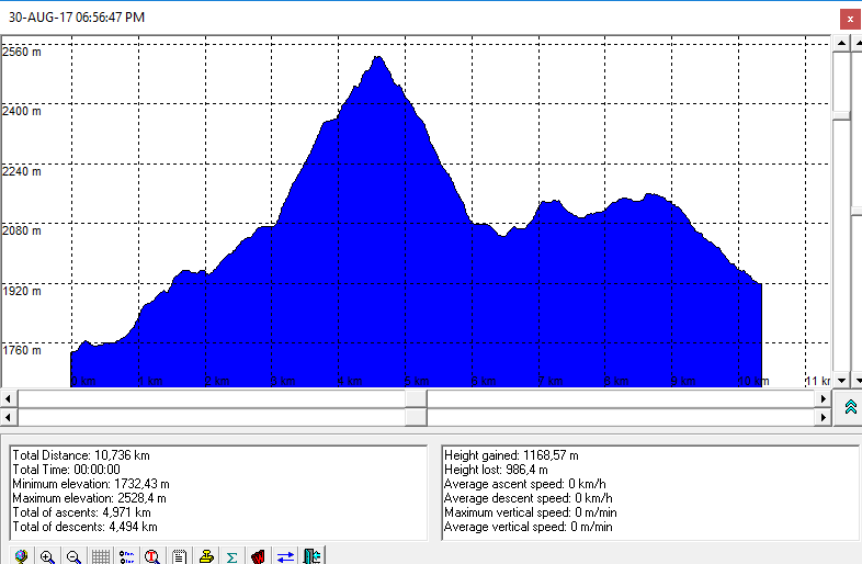
Duration of ascent: 3,5 h eff. (4 h - spent)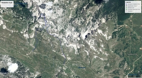
Notes from the trip:
Photo-album by Dražen is here.
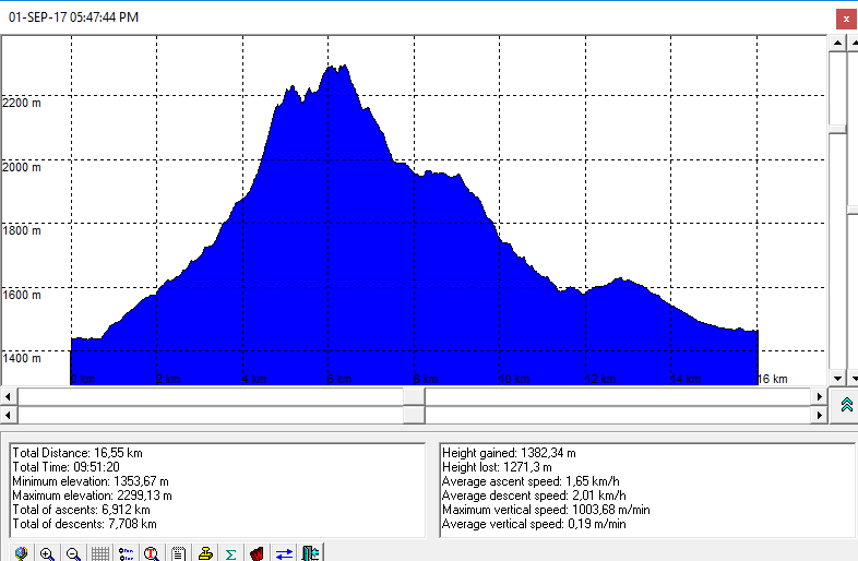
GPS tracks:
- Trail altitude profile is here
- In order to view GPS tracks from the trip to Bobotov Kuk in GoogleMaps application, please click on the map icon:
References:
-
Savin kuk @ summitpost.org
Savin kuk (2313 m), Istočni vrh Šljemena (2445 m), Šljeme (2455 m)

Tagline:
The route to Savin Kuku is shortened by means of the cable and we dcided to go to Šljeme. Ascent to Savin Kuk is very easy. The trail to Šljeme via Ždrijelo (throat) is very difficult because of steep, not well secured with no stable rocks parts.
Route:
- cable car of Ski Center "Savin kuk" - Savin Kuk Peak - Ždrijelo - Eastern Peak of Šljeme - Šljeme - road "Žabljak - Trsa - Plužine"
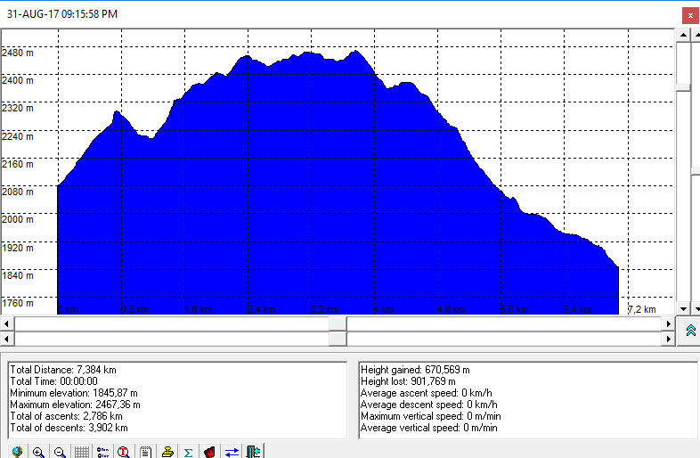
Duration of ascent:
Cable car - Savin Kuk: 40 min
Total duration of the trip: about 6,5 h of walking
Notes from the trip:
Photo-album by Dražen is here
GPS tracks: 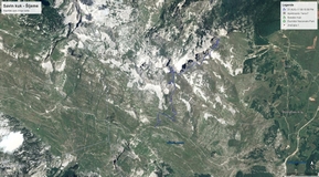
- Trail altitude profile is here
- In order to view GPS tracks from the trip to Savin Kuk and Šljeme in GoogleMaps application, please click on the map icon:
References:
Mali Međed (2223 m) - Međed (2287 m), Durmitor
Route:
- Žabljak, Crno jezero - Mali Međed - Međed - Velika kalica - Žabljak
Crno jezero - Međed: 4,5 h
Trajanje obilaska: 9 h
Tagline:
Moderate difficult trip to the peak that dominates over Black Lake (it makes the shadow over the lake). There is a difficult part at the route to Mali Međed with steep meadow (it could be very problematic during wet weather). There is beautiful view from Mali Međed toward Black Lake. The descent from Međed that goes on the reef is exposed but well secured.
Notes from the trip: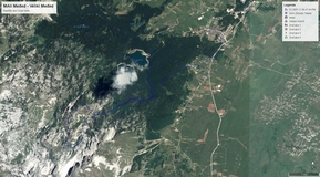
Fotoalbum by Dražen is here
GPS tracks:
- Trail altitude profile is ovdje
- In order to view GPS tracks from the trip to Međed in GoogleMaps application, please click on the map icon:
References:
- Medjed @ summitpost.org
Đurđevića Tara Bridge and Crno Jezero (Black Lake)
Tagline: Nice walking around Veliko Crno Jezero (Big Black Lake) and around Malo Crno Jezero (Small Black Lake). The rest of group has visited Ostrog monastery by bus.
- Photo-album by Dražen is here
Map:
- Durmitor, Tourist and mountaineering map, M 1:22000, Intersistem kartografija, Serbia
Related trip