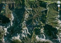
Route: Erjavec's Lodge (Vršič) - Slemenova Špica (1911 m) - Vršič (1611 m)
Starting point - Erjavec's Lodge or Vršič (1611 m)
Altitude difference: 350 m
Time needed: 2,5 h
Attractiveness: *** (of ***)
Difficulty: easy
Tagline: Easy but very attractive trip to the empire of the Julian Alps
Maps:
- Jalovec in Mangart, mountaineering map, M 1:25000, Planinska zveza Slovenije - Geodetski inštitut Slovenije
- Julijske alpe, vzhodni del (JulianAlps, Eastern part), mountaineering map, M 1:50000, Planinska zveza Slovenije - Geodetski Zavod Slovenije
- Triglavski narodni park, mountaineering map, M 1:50000, Planinska zveza Slovenije - Geodetski Zavod Slovenije
- Kranjska Gora z okolico, mountaineering map, Planinska zveza Slovenije
- SLO111200, Topographic map, M 1:25000
- Klick on the map icon in order to view the tracks in GoogleMaps:
 KML file with the GPS tracks from the trip
Photo-albums:
Approach:
- From Zagreb toward Ljubljana and Karavanke tunnel by Slovenian highway A2, exit Jesenice - zahod (the last exit before the tunnel!!!). Follow the signs to Kranjska Gora, then to Vršič. Totally 240 km or about 3 h driving from Zagreb.
Other interesting places:
- Russian chapel at Vršič road
- The source of Soča
References:
- Slemenova špica @ Hribi.net
- Urška in Andrej Stritar, Z otroki v gore, Sidarta, Ljubljana, 1998.
- The list of other mountaineering references is here


