")
")


Destination: Stap (860 m)
Starting point: Jelova Ruja (950 m), abandoned forester house and mountaineering shelter
Ending point: Jelova Ruja
Duration: 6 hours of walking
Difficulty: Easy to medium difficult signed trail
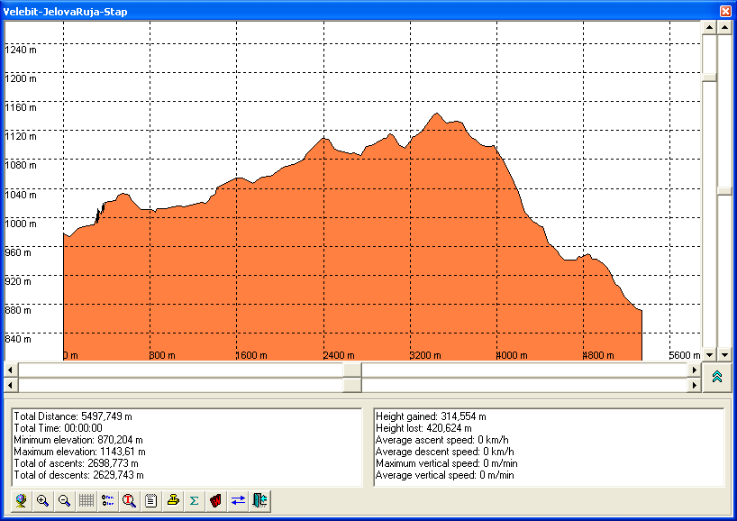
Altitude difference: 90 m* (see altitude profile)
Attractiveness: ** to*** (max ***)
- Usually, we go to mountains, and now we are going to the valley (from 950 m to 860 m). This part of Mt Velebit is less accessible (and because of this there is more walking) but it is worth seeing.
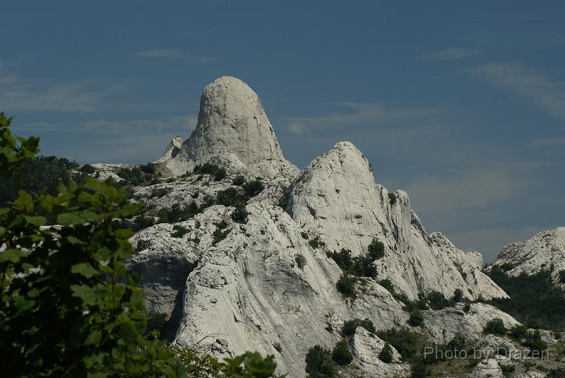
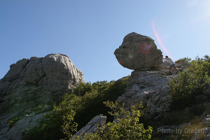
- Stap is one of most beautiful and romantic fields on whole Mt Velebit surrounded by white limestone cliffs. Here is placed Tatek's cabin, the mountain shelter. It is good starting point for few other small trips, Stoned gallery (a walk about 1 h), Stapina (stone-summit), Čučavac (stone)...
Introduction
- Planned route leads from to Stap. Another option is from Panos summit to Stap. Jelova Ruja and Panos are accessible by bad unpaved road from Brušani (village on the road Gospić-Karlobag).
- Jelova Ruja (950 m) is old, rusty forester house/rusty mountaineering shelter. Panos is a summit (1258 m), former military base and currently nice belvedere.
Approach to the begginning of the route:
- Jelova Ruja (28 km from Baške Oštarije, 17 km from Brušane, accessible* by car)
Appropriate season(s) for ascent:
- Summer. Stap is accessible in springtime or fall too. But, in that time more pleasant approach leads form the seaside:
- from St. Marija Magdalena (Mandalina) - 4 h
- from Ljubotić (branch from Tribanj - Kruščica) - 3 h


Planned route:
- Mountain lodge "PRPA" - Jelova ruja (28 km, by car)
- Jelova ruja - Stap (3 h)
- Option: Jelova Ruja - Panos (with car or by foot) - Stap
- Stap - Jelova ruja (3 h)
- Total: about 6 hours of walking
Route description:
- Using bad unpaved road from Brušane, via village Rizvanuša up to Jelova Ruja. It is needed to avoid branch to Visočica, or any off-road walking and driving on the northern side of Mt Velebit (in that area) due to suspicion to mine fields
- From Jelova Ruja (the trail starts behind it) right up, there are few times crossing with new forest unpaved road (it is easier to use this road, there are no signs but there are GPS tracks). After two hours of walking, there is branch to Debeli kuk and a sign. In order to reach Stap there is still about half hour of walking.
Accommodation:
Maps:
- Južni Velebit (Southern Velebit), Map No 18, M 1:25 000, SMAND, Varaždin, Croatia 2002.
- Map sketch with drawn GPS tracks (by Dražen)
- Topographic map TK-25 Gospić-2-1 (469-2-1), 1:25000, Državna Geodetska Uprava, Zagreb, CroatiaI
GPS data
Recommended equipment (summer):
- An appropriate rucksack, mountaineering boots, water, food and other equipment needed for whole-day walking on karstic terrain
References:
- Stap by Velebit @ SummitPost
- The list of other mountaineering references is here.