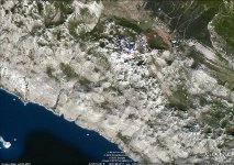
Destination: Bojin Kuk (Boja's Cliff - 1110 m) and other cliffs of the Bojinac Group
Beginning: Veliko Rujno (village near Starigrad)
End: the same as starting point
Duration: About 4 h of walking
Difficulties: Medium difficult (due to little rock climbing) signed trail
Altitude difference: about 200 m
Attractiveness: *** (from ***)
Tagline:
-
The traditional summer trip with meeting at Prpa Mountain Hut and visiting Bojinac - beautiful cliff with great view toward the sea and Veliko Rujno valley
Description:
-
Our destination is picturesque group of cliffs in Paklenica, National park. There are additional beautiful views toward the sea, Veliko Rujno valley (pilgrim place) and other peaks of Southern Velebit.
-
Traditionally, the gathering of group was at Prpa, mountain hut with the preparation of "čobanac". Next day, moving toward Starigrad by car and whole day hiking. After that - the refreshment in the sea.
-
In Sunday, we visited Tesla' Museum and springs of Gacka
Return: Sunday, July 18, in early afternoon
Photo-albums
- Bojinac by Dražen
- Panoramas of Bojinac and Gacka by Dražen
Route
- gathering - supper (barbecue)
- Mt. hut "PRPA" - Starigrad - Veliko Rujno, by car
- Veliko Rujno - Cliffs of Bojinac (there are few options) and return
- return via Adriatic touristic road with bathing at Starigrad
2nd day:
- Tesla Museum in Smiljan
- Visiting springs of Gacka
Route description
-
Bojin kuk by Velebit @ SummitPost
Maps and GPS tracks:
- Južni Velebit II (Southern Velebit 2), Map No 18a, M 1:30 000, SMAND, Varaždin 2008.
- Nacionalni park Paklenica (National park Paklenica), Map No No 19, M 1:25 000, SMAND, Varaždin 2008.
- Paklenica - hiking map, M 1:25 000, Astroida

- KML file (GoogleEarth TM)
- Information about accessing "Prpa" are on the page Baške Oštarije - approach and accommodation facilities
- Starigrad is accessible from highway A1 (Zagreb - Split), exit Maslenica
Accommodation:
- Mountain hut "PRPA" (927 m)
- Additional information about accommodation facilities at Oštarije see Baške Oštarije - approach and accommodation
Recommended equipment (summer):
- An appropriate rucksack, mountaineering boots, water, food and other equipment needed for whole day long walking on karstic terrain
- Paklenica National park (Mala and Velika Paklenica canyons)
- Krupa Canyon
- Zrmanja Canyon
- Tulove grede
-
Bojin kuk by Velebit @ SummitPost
- The list of other mountaineering references is here.
- The trail is placed in Velebit - Natural Park and National park Paklenica. Visiting rules must be strictly followed.