
Destinations:
- Vasojevićki Kom (2332 m)
- Kučki Kom (2499 m)
- Volušnica (1879 m) - Talijanka - Popadija (2587 m)
Baza: Andrijevica
Difficulty: From easy but long (> 6 h of walking) to very difficult routes in two the most interesting parts of Montenegro for hiking
Tagline: The trips of the first part of Ericsson Nikola Tesla hiking club annual trip - two summits in Komovi and one sightseen trip to Prokletije
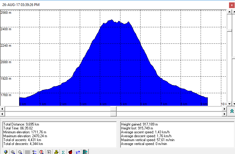
Vasojevićki Kom (2460 m), Komovi

Route:
- Eko Katun Štavna - Vasojevićki kom - Eko katun Štavna
Ascent duration: 3,5 h eff. (4 h - spent)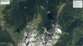
Notes from the trip:
Photo-gallery by Dražen is here.
Maps and GPS data:
- Visinski profil staze je ovdje
- In order to view GPS tracks from the trip to Vasojevićki Kom in GoogleMaps application, please click on the map icon:
References:
-
Vasojevicki Kom @ summitpost.org
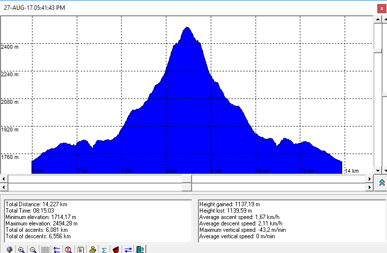
Kučki Kom (2487 m), Komovi

In short:
A little bit more difficult than Vasojovički kom. The most unpleasant part are a couloir above peak (because of non stable rocks) and the reef before peak (exposed but short).
Route:
- Eko Katun Štavna - Kučki kom - Eko katun Štavna
Ascent duration: 4,5 h eff (4.5 h - spent)
Notes from the trip:
Photo-gallery by Dražen is here
Maps and GPS data: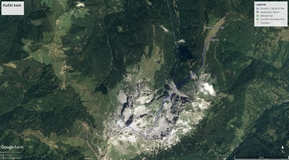
- Altitude profile is here
- In order to view GPS tracks from the trip to Kučki Kom in GoogleMaps application, please click on the map icon:
References:
-
Kučki kom @ summitpost.org
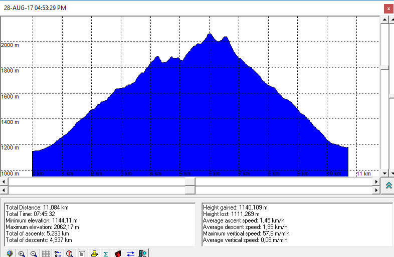
Volušnica (1879 m) - Talijanka - Popadija (2057 m), Prokletije

Route:
- Grebaje - Volušnica - Talijanka - Popadija - Grebaje
Duration: 7:45 h - spent
Notes from the trip:
Photo-gallery by Dražen is here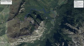
Maps and GPS data:
- Altitude profile is here
- In order to view GPS tracks from the trip to Volušnica and Popadija in GoogleMaps application, please click on the map icon:
References:
- Popadija @ summitpost.org
Boka Kotorska Bay

In short:
Na putu prema Andrijevci, našoj bazi za uspon na Komove, obišli smo Perast i svetište Gospe od Škrpjela, Dobrotu i grob dona Branka Sbutege i Kotor te zastali kod manastira Morača
Notes from the trip:
- Photo-gallery by Dražen is here