")
")


Destination: Martuljški Slapovi (Martuljek Waterfalls), Mangart, Krn Lakes
Accommodation: apartments in Bovec
Difficulty: from easy signed trails to moderate via feratas
Duration: 4 days
Description: Three hiking trips in Julian Alps around Bovec. and the forth, unplanned, the rafting on Soča River.
Routes: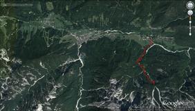
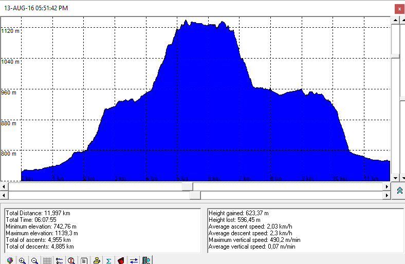
- Gozd Martuljek - Martuljek Waterfalls - Gozd Martuljek
- Koča pri izvoru Soče (The Lodge at the Soča Source) - Soča Source
- Duration : 15 min
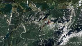
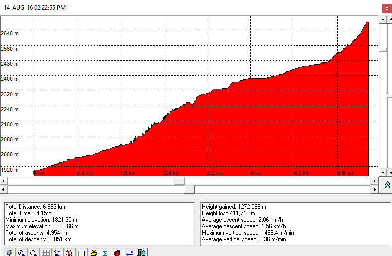
- Mangart Saddle - Slovenian trail (ferrata) - Mangart - Talijanska pot - Mangartsko sedlo
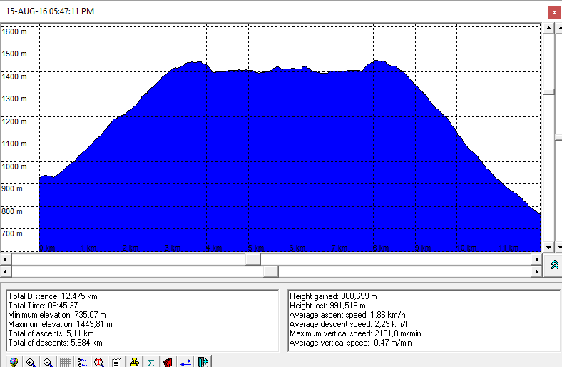
- Dom v Lepeni (700m) - Dom pri Krnskih jezeri (1385 m) - Krn lake (1391 m)
- Photoalbum from rafting on Soča is here
Maps:
-
Kranjska Gora z okolico, hiking map, M 1:25.000, Planinska Zveza Slovenije.
-
Triglavski narodni Park, hiking map, M 1:50.000, Planinska Zveza Slovenije.
-
Julijske Alpe. Zahodni del (Julian Alps, Western Part), hiking map, M 1:50.000, Planinska Zveza Slovenije.
